Learning my way around the district with QGIS + Anki
, 4 min, 613 words
Tags: mount-erie-fire gis
At the start of this year, I rejoined Mount Erie Fire Department (MEFD), a volunteer fire + rescue district just south of Anacortes, WA. Onboarding with the district involves learning a great deal: about fire, rescue, EMS, standard operating procedures...and the district itself.
Here's the thing: I have the worst sense of direction of anyone I've ever met. Like, I once got lost in a large parking lot. So the prospect of learning my way around an unfamiliar area was daunting, to say the least. The standard suggestion from experienced members was "oh, go drive around in your free time, you'll figure it out." Which is great for them! But I don't have that kind of faith in my navigational skills or memory. After a bit of messing around, I ended up finding a pretty solid way to get to know the district, so I wanted to share it in case it might be useful to others.
The big picture:
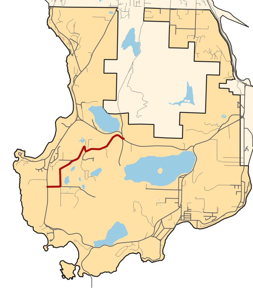
- I used QGIS and some general geographic know-how to generate an image highlighting every street in the district, with a general map as a backdrop. More info on how exactly I did that here. The result looked something like this:

- I put together a flashcard for every street in Anki, and ordered them so I'd learn big roads first and learn roads near each other in quick succession.
- I studied. A lot. For a couple of months. I did all the cards in "pick out the road on the map" mode first, then once I'd seen all of those once I incorporated the reverse – "look at this map; what is the name of the highlighted road?"
- Once I'd seen all the streets in flashcard form at least once, I started exploring. By bike where I could, by car where needed, once even on foot near the station. I took notes while I explored, not for my own reference (maybe someday?) but just so that I had something to actually do on each street.
- I asked loooooots of questions – "is the fastest way there along Campbell Lake or Rosario?" "Where's the cutoff point for going north versus south on highway 20 for Gibralter Road?" "So to get back to the station from here, are we going to go all the way to the end of Biz Point Road and use the turnaround there?" I learned a lot from the answers I got, with a side bonus of showing folks I was really putting in the effort to learn things, even if it was slow going.
And it's not like one can just stop learning with the streets. I'm still adding flashcards for landmarks ("huh? what's Western Bud?" -Zeph, trying to find an MVA one evening) and building other flavors of district familiarity. Things like what areas have hydrants and where, which areas are likely to be most difficult to protect from wildfire, how to navigate when there's construction or road repair work going on...but now I'm building all that on a solid foundation.
As a side benefit, I feel way more connected to the district now; there's something special about knowing it well and continuing to learn about it all the time, which I've never experienced in this way before.
Want to learn the roads in Mount Erie Fire's area? Instructions here.
Want to learn how the heck to do this for your own area? Discussion here.